FishTrack provides saltwater anglers with everything they need to find fish. The FishTrack app offers free cloudfree sea surface temperature (SST) charts, global satellite imagery and marine weather forecasts – all in one layered tool.
With FishTrack you can:
- View the latest SST, chlorophyll and true color satellite imagery
- Overlay bathymetry, ocean currents and sea surface height
- Save waypoints to mark fishing spots and catches
- Create routes to plan a trip and view distances and headings
- View marine weather forecasts and tides/solunar tables
- Save fishing chart imagery for offline use
- View your current location both online and offline
Don't fish blind! FishTrack helps you plan a productive trip offshore. Burn less fuel and find fish faster.
We want to hear from you! Submit your questions or comments through our app to let us know what you think. If you'd like to speak directly with our customer service team, please e-mail us at: support@fishtrack.com.
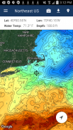
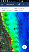
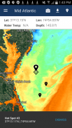
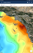
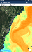
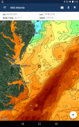
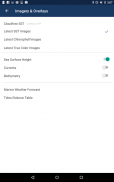
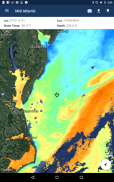
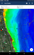
FishTrack cung cấp câu cá nước mặn với tất cả mọi thứ họ cần để tìm cá. Ứng dụng cung cấp FishTrack cloudfree nhiệt độ bề mặt nước biển (SST) Bảng miễn phí, hình ảnh vệ tinh toàn cầu và dự báo thời tiết biển - tất cả trong một công cụ phân lớp.
Với FishTrack bạn có thể:
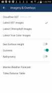
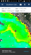
- Xem thuế TTĐB mới nhất, chất diệp lục và hình ảnh vệ tinh màu sắc trung thực
- Lớp phủ độ sâu, dòng nước biển, mặt biển chiều cao
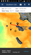
- Lưu waypoints để đánh dấu các điểm câu cá và đánh bắt
- Tạo các tuyến đường để lên kế hoạch một chuyến đi và xem khoảng cách và tiêu đề
- Xem dự báo thời tiết biển và thủy triều / bảng câu cá câu cá
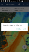
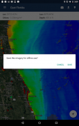
- Lưu biểu đồ hình ảnh câu cá cho sử dụng offline
- Xem vị trí hiện tại của bạn cả online và offline
Đừng cá mù! FishTrack giúp bạn lập kế hoạch một chuyến đi sản xuất ở nước ngoài. Burn ít nhiên liệu và tìm cá nhanh hơn.
Chúng tôi muốn nghe từ bạn! Gửi câu hỏi hoặc ý kiến của bạn thông qua ứng dụng của chúng tôi để cho chúng tôi biết những gì bạn nghĩ. Nếu bạn muốn nói chuyện trực tiếp với đội ngũ dịch vụ khách hàng của chúng tôi, xin vui lòng e-mail cho chúng tôi tại địa chỉ: support@fishtrack.com.
FishTrack provides saltwater anglers with everything they need to find fish. The FishTrack app offers free cloudfree sea surface temperature (SST) charts, global satellite imagery and marine weather forecasts – all in one layered tool.
With FishTrack you can:
- View the latest SST, chlorophyll and true color satellite imagery
- Overlay bathymetry, ocean currents and sea surface height
- Save waypoints to mark fishing spots and catches
- Create routes to plan a trip and view distances and headings
- View marine weather forecasts and tides/solunar tables
- Save fishing chart imagery for offline use
- View your current location both online and offline
Don't fish blind! FishTrack helps you plan a productive trip offshore. Burn less fuel and find fish faster.
We want to hear from you! Submit your questions or comments through our app to let us know what you think. If you'd like to speak directly with our customer service team, please e-mail us at: support@fishtrack.com.